Our journey is prepared by using Skyvector (www.skyvector.com) in order to simulate our flightplans
Our expedition, directly form Basiy – Thy (EBBY) www.ulm.be to Oshkosh,
will be 3.563 Nm (6.599Km) and would take 30 hours of flight time
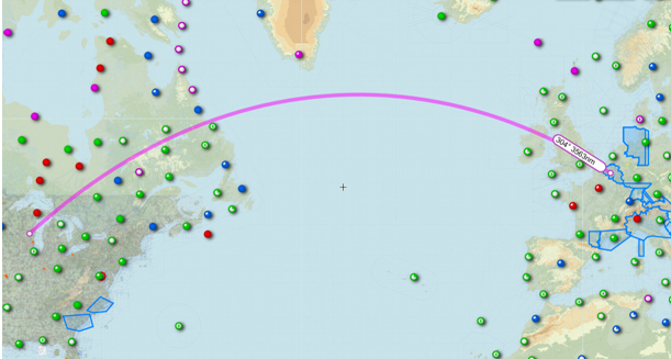
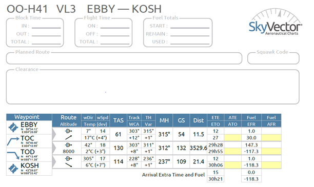
Of course, this would be impossible with our planes, the journey will be done in
several legs passing by the North.
Here is an idea we have to go by the “Big North”.
Useless to mention that this track will be modified in function of our spirit but
essentially by metrological conditions.
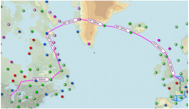
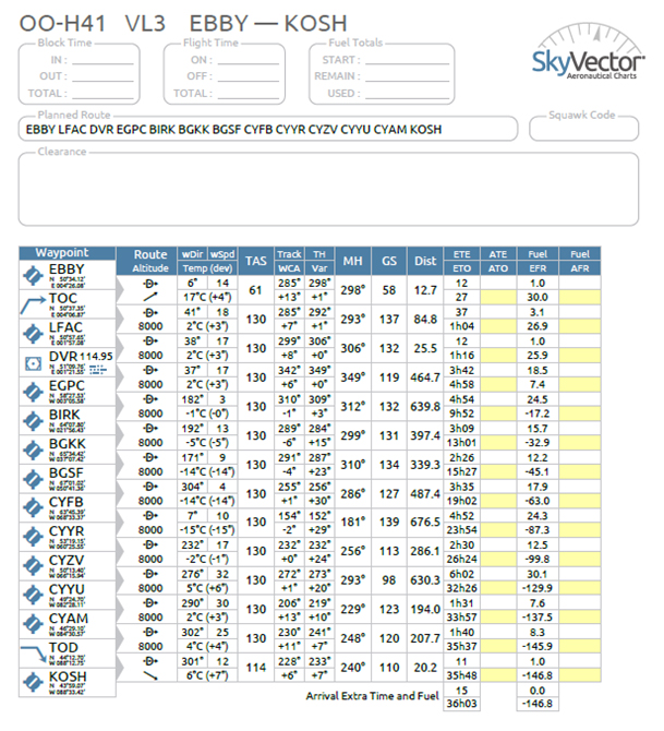
It is remarkable that the mission via the north extend the flight time by
only 6 hours, in fact, if we could do all tracks the flight time would be 36 hours
instead of 30 hours.
The distance traveled via this route will be 4.466.40 Nm (8.271.71 Km)
a little detour of 930.40 Nm (1674 Km).
Also this will be impossible, crews and machines need refueling, maintenance and some rest.
We propose you to look at this more detailed, by cutting our mission in several legs.
This will give you a more realistic view.
Fist leg: EBBY (Baisy-Thy) – LFAC (Calais) – DVR – EGPC (Wick)
Distance: 587 Nm (1.088Km)
Flight time: 05:04h (without the customs stop in Calais)
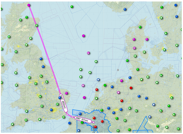
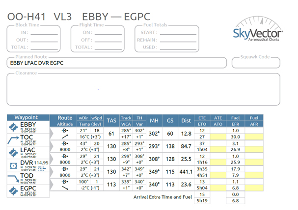
This first step will lead us to LFAC (Calais customs airport) where we have to clear customs
because we leave the Shengen space destination Wick.
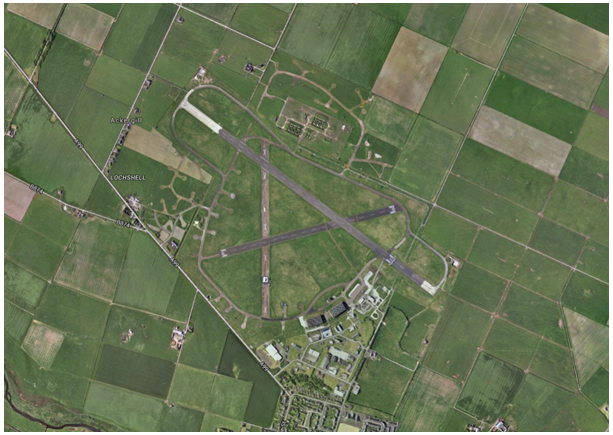
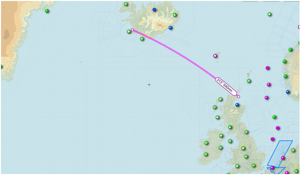
2nd leg: EGPC (Wick) – BIRL (Reykjavic)
Distance: 639.8 Nm (1.185Km)
Flight time: 05:22 h.
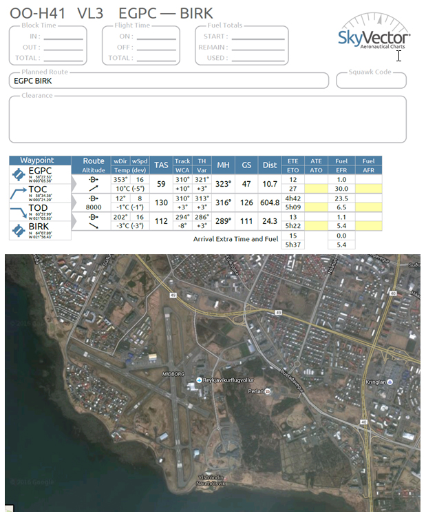
More details of the airport are here:
https://skyvector.com/airport/BIRK/Reykjavik-Airport
3th leg: BIRL (Reykjavic) – BGKK (Kulusuk) – BGSF (Kangerlussuaq)
Distance: 736.7 Nm (1.364Km)
Flight time: 05:52 h
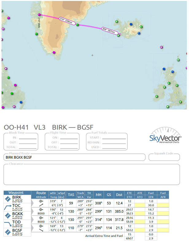
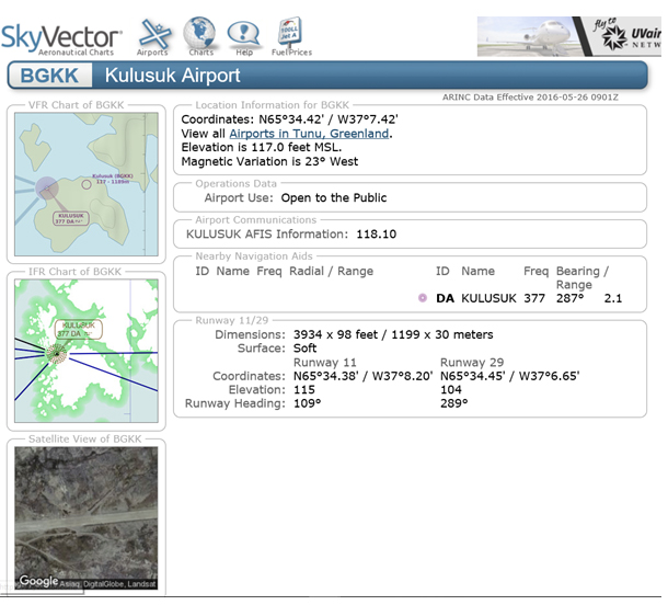
More details of the airport BGKK (Kulusuk, refuelling airport) can be find here:
https://skyvector.com/airport/BGKK/Kulusuk-Airport
Destination: Kangerlussuaq:
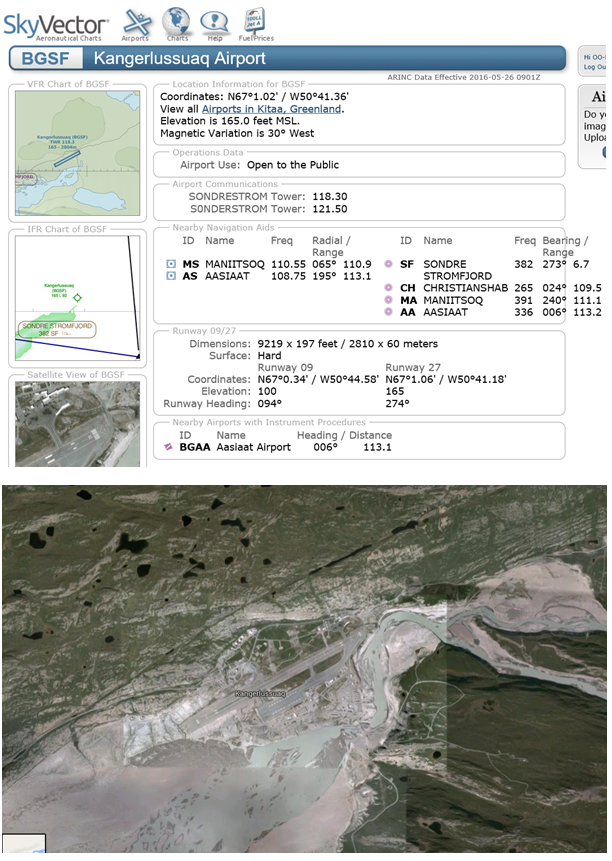
Look at https://skyvector.com/airport/BGSF/Kangerlussuaq-Airport
for more details concerning Kangerlussuaq.
4th leg : BGSF (Kangferlussuaq) – CYFB (Iqaluit) – CYYR (Goose Bay)
Distance: 1.265Nm (2.344Km)
Temps de vol: 10:02 h
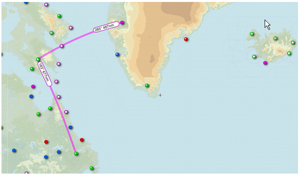
Details of CYFB (Iqaluit, refuelling airport)
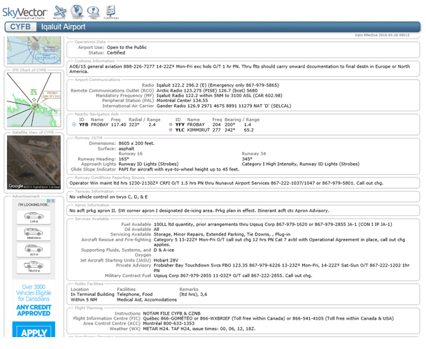
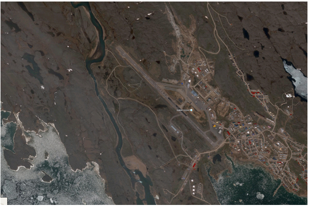
More details of this airport … please click on :
https://skyvector.com/airport/CYFB/Iqaluit-Airport
Destination of this 4th leg: CYYR (Goose Bay)
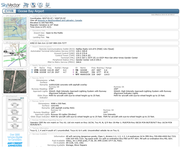
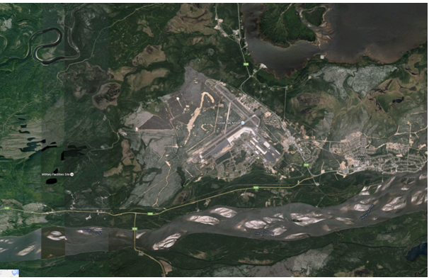
You want to see it all concerning Goose-Bay,
it’s here: https://skyvector.com/airport/CYYR/Goose-Bay-Airport
5th leg : CYYR (Goose Bay) – KGRB (Austin Straubel International Airport)
Distance: 1.208Nm (2.237Km)
Flight time: 08:46 h
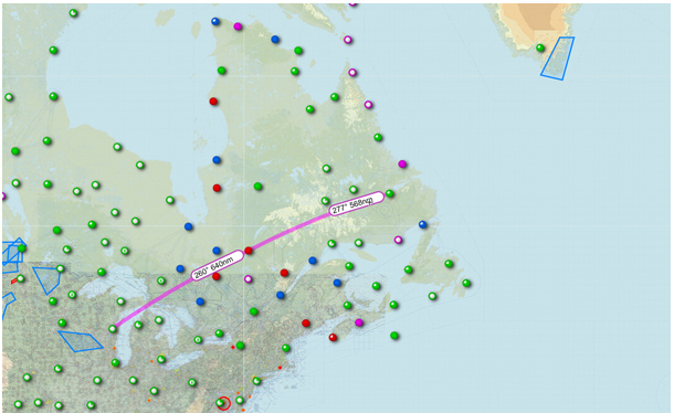
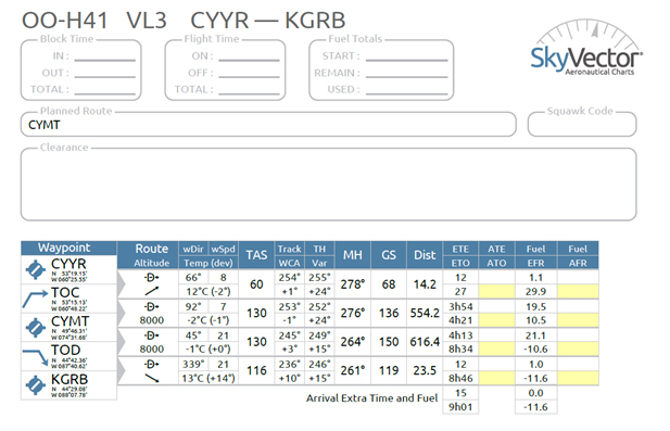
Also for this leg we have to refuel at, CYMT (Chibougamau)
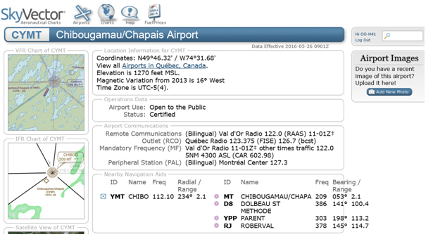
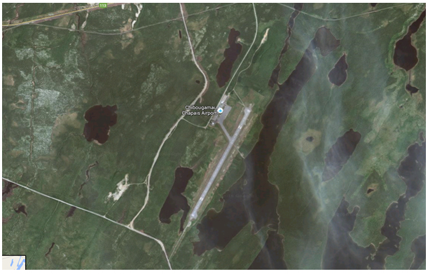
All you want to know about CYMT is on:
https://skyvector.com/airport/CYMT/Chibougamau-Chapais-Airport
Destination KGRB (Austin Straubel International Airport),
Entry airport for the USA and customs.
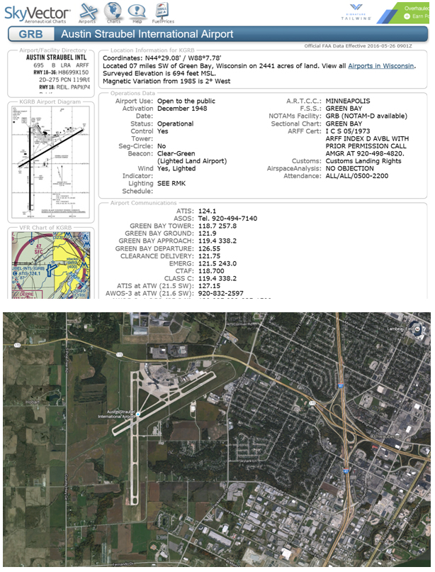
Click here for more details:
https://skyvector.com/airport/GRB/Austin-Straubel-International-Airport
6th leg : KGRB (Austin Straubel International Airport) – KOSH (Oshkosh)
Distance: 35Nm (65Km)
Flight time: 00 :35 h
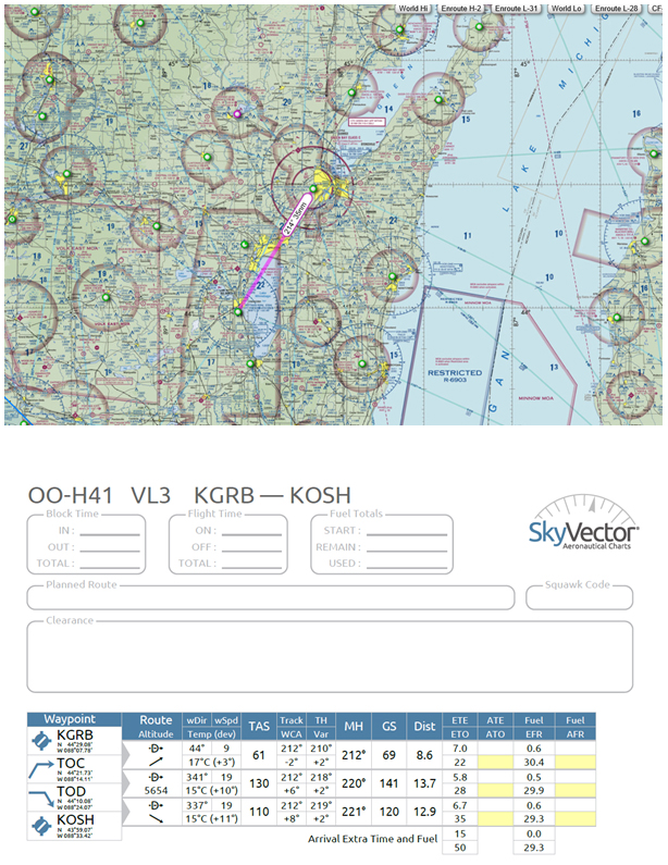
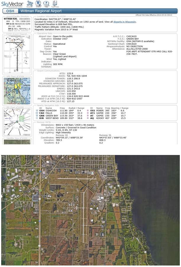
All details are on the Skyvector site :
https://skyvector.com/airport/OSH/Wittman-Regional-Airport
Final destination:
http://www.eaa.org/en/airventure
Many thanks to Marie-Claude Lefevre for the translations.


Don’t forget to check MSA over the icecap between BGKK-BGSF, 8000′ is a bit low. But you will be informed of the actual MSA from Sondrestrom Information, and when filing the flight plan at BGKK.
Too bad I am not in Greenland until July 16th, hope to catch you on the way back.